County has ‘slight’ risk for severe weather Wednesday into Thursday
Published 9:28 am Tuesday, April 12, 2022
|
Getting your Trinity Audio player ready...
|
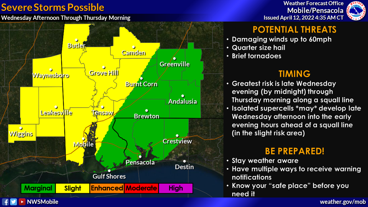
Most of Escambia County, Ala. is under a slight risk of severe weather Wednesday going into Thursday, according to the Escambia County EMA office.
According to the National Weather Service, two rounds of strong to severe storms are possible with the first round of storms being conditional, meaning forecasters aren’t sure if it will actually materialize.
Isolated supercells might develop late Wednesday afternoon through the early evening in the slight risk area, according to the NWS.
The greatest risk for severe weather will be associated with the second round of storms late Wednesday evening through Thursday morning as a squall line enters the area, NWS officials said. The squall line will likely enter southeast Mississippi around midnight and slide across communities generally west of Interstate 65 through the overnight hours.
Storms along the squall line will be capable of producing winds up to 60 miles per hour, quarter-size hail and brief tornadoes throughout the overnight hours. As the squall line slides east of I-65 by sunrise, the environment will be less favorable for severe storms. Storms will also be capable of producing very heavy rainfall and localized flash flooding is possible, especially across low-lying and urban areas. The greatest risk for flooding will be overnight into early Thursday.
According to the NWS, the greatest potential for severe weather is generally west of I-65. The greatest potential for flooding is across the entire area.
Confidence is very low that the first round of storms will materialize. Confidence is increasing in the threat of strong to severe storms along a squall line overnight into early Thursday. Confidence continues to increase in the potential for localized flash flooding.