NWS: Irma will turn north Saturday into Sunday
Published 1:16 pm Friday, September 8, 2017
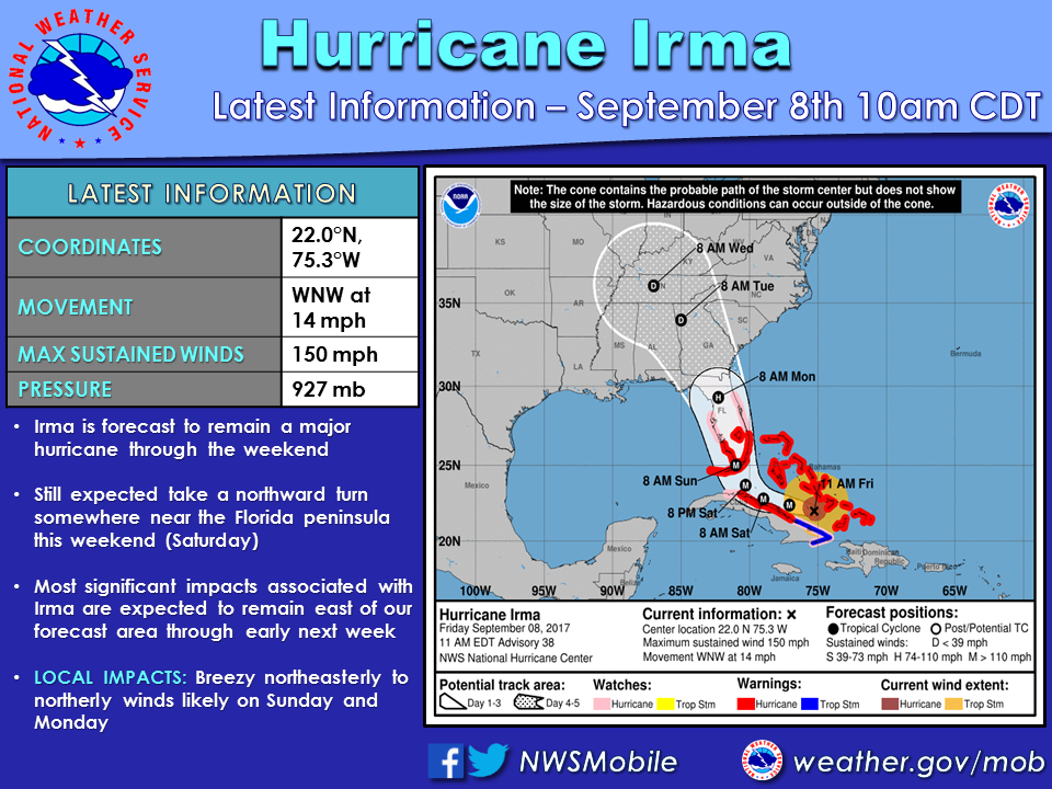
National Weather Service meteorologists are still encouraged that Hurricane Irma will turn north Saturday night into Sunday, effecting the Florida Peninsula.
According to the NWS, Irma’s westward shifting of the track has ceased as of Friday afternoon.
“There will likely be an expansion of the large scale wind field as it moves up the spine of the Florida Peninsula on Sunday and into Monday,” Meteorologist in Charge Jeffrey Medlin said. “As it approaches the northern Florida peninsula and then passes further to the northwest into Georgia, surface winds will pick up across our area by early Monday through late Monday night.”
Medlin said wind speeds will be lower in southeast Mississippi and higher in south central Alabama and northwest Florida Panhandle.
“That will be the peak time to receive 20 to 30 mile per hour sustained winds across our region with higher gusts — generally 25 to 35 miles per hour, especially from Pensacola east to Destin where gusts may be closer to 40 miles per hour at times,” he said. “Again, the wind will be the main impact. With offshore winds, tide levels will decrease below their astronomical predictions. “
Medlin said inland areas of south central Alabama will likely be close enough to receive 20-30 mile per hour winds as well, with higher gusts on both Monday afternoon and evening.
Escambia County EMA Director David Adams said the county will likely see some gusty winds from the north through the weekend, and maybe the first part of next week.
“Keep in mind that the forecast can change and a slight change to the west can mean significant changes for us,” Adams said.