Nate update: Heavy rain expected in west end of county
Published 8:54 pm Saturday, October 7, 2017
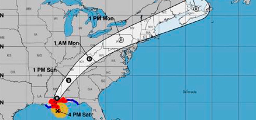
Hurricane Nate has made its first landfall as a Category 1 storm near the mouth of the Mississippi River, the National Hurricane Center said Saturday evening.
The hurricane center said NOAA Doppler radar data indicated that the center of Nate was making landfall at the mouth of the Mississippi River as of 7 p.m. CDT. A second landfall is anticipated later tonight in Mississippi, forecasters said.
Escambia EMA director David Adams said in his evening briefing that no further strengthening is expected.
Forecasts now show most of the impacts farther west than initially predicted, which is good news for Escambia County.
Significant rainfall is still forecast in the western end of Escambia County. Residents should expect between three and five inches of rain over the next several hours, Adams said.
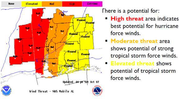
The threat has shifted west, making it less likely the county will see tropical force winds.
Most of Escambia County has between 50-80 percent chance of experiencing tropical storm force winds, he said.
Nate is still moving NNW at 23mph, he said, and the eye of the storm is expected to make landfall near Gulfport, Miss., around midnight. The forecast track calls for Nate to start turning to the north and then to the northeast through the night.
Sunday afternoon Nate should be over north Alabama as a tropical storm.