Severe weather threat slated for Wednesday
Published 4:15 pm Monday, March 15, 2021
|
Getting your Trinity Audio player ready...
|
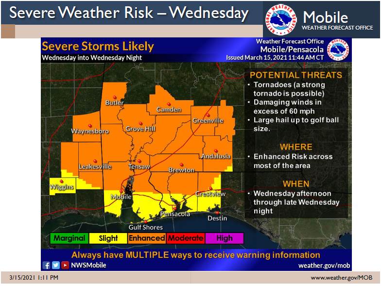
An enhanced risk of severe weather for most of the area is slated for Wednesday, according to the National Weather Service.
According to NWS officials, all modes of severe weather are possible, from tornadoes, damaging winds and large hail.
The timing of the storms will come into better focus Tuesday into Wednesday, according to the NWS.
On Wednesday, the severe potential could start this afternoon. The threat will increase late today into the evening hours and will gradually spread eastward.
The severe threat will likely stick around after midnight, especially for areas east of the interstate. The threat may not end until approximately 4 a.m., according to the NWS.
There is still uncertainty on the exact timing, evolution and extent of the weather.