Severe storms possible Thursday
Published 11:50 am Wednesday, March 24, 2021
|
Getting your Trinity Audio player ready...
|
Here is a weather update from the National Weather Service’s Mobile office’s Facebook page:
Rain showers and thunderstorms continue this morning across southwestern AL, southeastern MS, and the FL panhandle. Rain and thunderstorms increase in coverage tonight as a warm front lifts north through the area. A flash flood watch remains in effect through Friday morning. Additional rainfall totals of 2″ to 4″ remain possible over the flash flood watch area, with locally higher amounts to 6″ possible where rain and thunderstorms continually train over the same area.
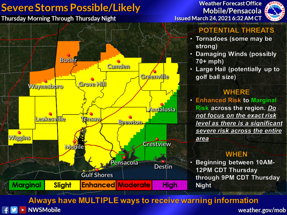
A marginal risk for severe storms exists tonight with damaging winds and large hail as the warm front lifts north. A more substantial severe threat evolves Thursday, with tornadoes (some strong), damaging winds to 70+mph, and large hail to golf ball size are possible.