Showers, T-storms to develop across coastal areas today, tonight
Published 2:22 pm Wednesday, March 24, 2021
|
Getting your Trinity Audio player ready...
|
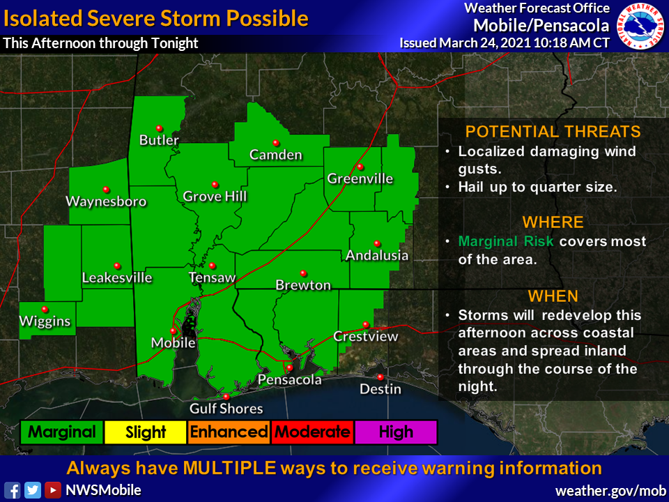
Showers and thunderstorms are forecasted to develop across coastal areas this afternoon and early evening, according to the National Weather Service.
“These storms will spread inland tonight,” NWS officials said on their Facebook page. “An isolated severe storm cannot be ruled out. In addition, localized flash flooding is also possible.”
NWS officials said after a lull early Thursday morning, a significant severe weather threat will develop, especially across far inland southwest Alabama and southeast Mississippi.
“That’s the area we have the higher confidence in severe weather and those areas are under an enhanced to moderate risk. There is the threat for strong tornadoes.”
According to an NWS graphic, Escambia County, Ala. and Fla. are under a marginal risk.
“Further south and east across the area in the Slight and Marginal risks, we have less confidence on storms developing,” officials said. “However, if a storm can develop, then it could quickly become severe with the threat of tornadoes. Everybody should remain alert through the day tomorrow.”
Additionally, weather forecasters said it’s going to be windy on Thursday. Frequent wind gusts of 30-40 mph are expected. A few gusts higher than 40 mph are possible. A Wind Advisory is in effect.
The surf will also be very dangerous through this weekend, even for experienced swimmers. A high risk of rip currents is in effect through Sunday.