Storms to impact area sooner rather than later tonight, tomorrow
Published 4:25 pm Tuesday, January 24, 2023
|
Getting your Trinity Audio player ready...
|
The storms slated to sweep through the area tonight and early tomorrow morning will blow through the area quicker than previously forecasted, according to the National Weather Service.
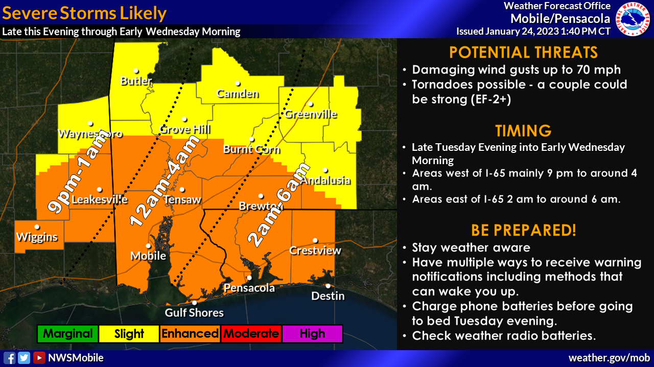
Officials with the NWS said the line of storms set to move across the area tonight looks to do so a bit more quickly. Forecasters have adjusted the timing on the severe weather threat graphic such that the ending time looks to be 6 a.m.
Additionally, forecasters have expanded the high wind warning to include Wayne County, Miss. and Choctaw and Clarke Counties in southwest Alabama.
According to the NWS, a wind advisory is now in effect tonight generally for south central Alabama.
Here are some other points of interest relating to tonight’s storms:
- WHAT: Severe storms capable of producing damaging winds up to 70 mph and tornadoes. A couple tornadoes could be strong (EF-2+).
- WHEN: Entering southeast Mississippi and interior southwest Alabama after 9 PM this evening, progressing to near the I-65 corridor by 1-4 AM, then moving across the rest of south central Alabama and the western Florida panhandle between 2-6 AM early Wednesday morning.
- WHERE: Across the entire area.
- CONFIDENCE: Moderate to high confidence that an impactful severe weather event will affect the area.
High Gradient Winds
- WHAT: Strong winds sustained between 25-40 mph with gusts of 50 to 55 mph.
- WHEN: 6 pm this evening to 6 am Wednesday, possibly with a Wind Advisory extending later into Wednesday morning.
- WHERE:Across the entire area.
- CONFIDENCE: Highest across portions of southeast Mississippi, far southwest Alabama, and the western Florida panhandle where the High Wind Warning is in effect. Moderate confidence elsewhere.