Zeta has winds of 90 mph, moving north
Published 12:09 pm Wednesday, October 28, 2020
|
Getting your Trinity Audio player ready...
|
UPDATE: Gov. Kay Ivey just issued the following statement about the strengthening Hurricane Zeta.
“Hurricane Zeta is gaining intensity, and it is critical that all Alabamians are prepared and keep a close watch on this storm. As this system evolves, the folks even in the central part of our state should be prepared for the potential of tropical-force winds. We are concerned for the potential of power outages, heavy and fast-moving rain across the state and storm surge along our coast. I urge everyone to quickly finish your preparations this afternoon and stay off the roads tonight, if possible. Alabama, please tune in to your trusted weather source, and listen to all local advice. Zeta is gaining strength and will certainly give a punch to our state, and we all must be ready. Stay safe.”
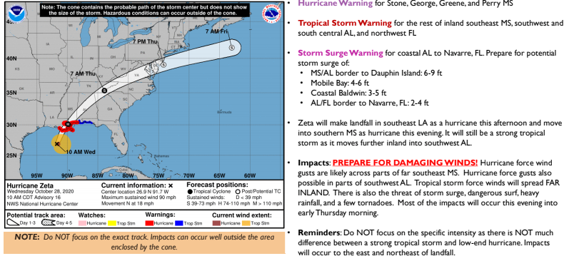
Escambia County EMA Director David Adams said in a release that Hurricane Zeta has sustained winds of 90 miles per hour and is moving north at 18 mph.
“The storm is expected to make landfall in southeast Louisiana late this afternoon and continue to the northeast through the night,” Adams said.
Adams said that chances are high that we will see some tropical-storm force winds in Escambia County during the night tonight.
“The forecast rainfall totals have dropped some to 0.5-2 inches in our area, with some locally higher amounts possible,” he said. “Some tornado activity is possible.”
Adams said confidence is high on the forecast.
“Hurricane Zeta is expected to increase in forward speed and severe weather should clear the area Thursday morning,” he said.